
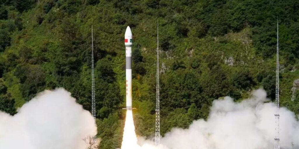
Webdesk: In a major milestone for Pakistan’s space programme, the country’s latest remote sensing satellite was successfully launched into space today, July 31, from China’s Xichang Satellite Launch Centre.
The launch was scheduled between 7:00 and 8:00 AM Pakistan Standard Time.
According to the national space agency SUPARCO, all preparations for the satellite’s launch had been completed in advance.
Pakistani scientists and engineers were already present at the Chinese launch site to oversee the mission.
This successful launch of the satellite is a significant milestone in the scientific and technological development of Pakistan.
Not only does it enhance the capability of the country in terms of monitoring and control of natural disasters such as floods and earthquakes. But it also helps in improved urban planning and environmental surveillance.
Pakistan, with such success, becomes less reliant on foreign data, self-sufficient strategically, and improves its space capabilities.
It is also an indicator of an increasing regional significance and establishes a robust platform for future space technology development. It is also motivational to the next generation of scientists and engineers.
A SUPARCO spokesperson described the launch as a significant achievement for Pakistan’s scientific and technological progress.
🇵🇰✨ Alhamdulillah!
— Ahsan Iqbal (@betterpakistan) July 31, 2025
Another URAAN of Pakistan!
With the successful launch of our 4th Earth Observation Satellite from XiChang, China, Pakistan Space Programme has once again soared to new heights. 🚀
Congratulations to the people of Pakistan!
Today marks another proud moment for… pic.twitter.com/4s6iy7alsT
The satellite will be utilised in environmental surveillance, natural disaster management, early earthquake warnings, and urban development.
The satellite will be able to assist in the timely identification of natural calamities like floods, earthquakes, tremors and soil erosion due to its sophisticated remote sensing technology.
It will also be instrumental in observing developments in infrastructure and urbanisation of various areas within Pakistan.
In Islamabad, a special event took place at SUPARCO headquarters, where scientists, government officials and other guests witnessed the launch in real-time.
One of the highlights of the ceremony was a video message by the project director, Dr Muhammad Yasar, who is in China.
This achievement is a significant milestone in the space aspirations of Pakistan and will greatly increase the remote sensing and disaster management capabilities of the country.
The successful launch of a satellite by Pakistan into space, which was aided by Chinese support, is an indication that the strategic and technological partnership between both nations is growing, much to the discomfort of India.
It reduces the space-tech gap of South Asia and introduces a competition layer to remote sensing and surveillance options.
In the case of India, this reminds them that Pakistan is making steady progress in a number of areas that are of both civilian and military significance.
Read more: Pakistan weather update: PMD warns of flash floods, landslides amid widespread thundershowers